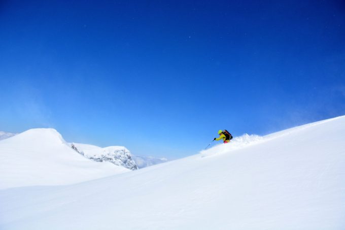
The mountain passes made famous by cyclists are just as well known by springtime skiers and the high departure point, which is easy to access, leads to some fabulous routes. This area is a must for the wide-ranging views.
About : Ski touring from le Rieu Claret / Belledonne
To reach Rieu Claret and the mountain passes after the Lac de Grand Maison, you need to wait until the road officially reopens because even if there is natural thawing, the road remains closed until May (www.savoie-route.fr).
The Refuge de l’Etendard, which is often open, provides a gateway to the St-Sorlin glacier from where you can reach, among others, the top of the Etendard, the “boss” of the Grandes Rousses (or boss no 2... after the Pic Bayle).
SUGGESTIONS FOR SKI-TOURING
> Discovery day routes :
- Rocher Blanc (2927 m) + 1180 m
This is the great classic of spring: the summit of the Rocher Blanc by the Col de l'Amiante is a must for those who like to get up early (it gets hot at this time). The view from this belvedere Belledonne well worth the morning time of the awakening!
- Pic de l'Agnelin (2740 m) +1050 m
PRACTICAL INFORMATION
> Getting supplies: Allemond: bakery, mini-market, restaurants.
- Rivier d'Allemond: La Ferme du Rivier (cheese) 06 27 34 18 19.
Saint Sorlin d'Arves: bakery, mini-market, restaurants.
> Accommodation: Allemond: hotel, B&Bs, gîtes.
EAU D'OLLE / BELLEDONNE SECTOR
As soon as your enter Oisans from Grenoble, the Eau d'Olle valley catches your eye... and lures you back again and again… it’s so varied and so beautiful! The routes extend from the village of Allemond up to the Col de la Croix de Fer, from the foothills of the Belledone to those of the Grandes Rousses.
The pointed peaks on the horizon tease city-dwellers during the week and each weekend, the summits cause a mini-exodus from the city to the mountains. Yet approaching from the Oisans side, on skis from the Eau d'Olle valley, you’re sure to be well away from the crowds.
There are different versions of the origin of the name “Belledonne”. Some say it comes from “bella donna”, as Italian workers thought the shape of the Grand Pic looked like the Virgin carrying her child. The Gauls, on the other hand, used the word “belo” to mean strong or powerful, which accurately describes this solid crystalline mountain range, 60 km long, with wide shoulders but narrow 10 km hips.
The highest point, the Grand Pic de Belledonne, verges on 3000 m. It sometimes looks arrogant like the Fitzroy in Patagonia or a black virgin, depending on your point of view. In any case, the Belledonne is a real natural barrier, a citadel of schist and gneiss (and a little granite, of course) and is one of the most untamed mountain ranges in France.
/!\ IMPORTANT
Ski mountaineering and touring involves risks and all skiers are responsible for their own safety. Make sure you follow ANENA guidelines: anena.org
En bref
French
Opening
May, when the road has reopened (www.savoie-route.fr)
Prices
Free of charge.
Location supplement
Drive to Allemont and on the Verney dam follow signs for “Col du Glandon”. Go through Le Rivier d'Allemont and carry on to the Lac de Grand Maison. Rieu Claret is on the left at the end of the lake (park along the side of the road).

