4978836-diaporama
778711-diaporama
778709-diaporama
778710-diaporama
10176447-diaporama
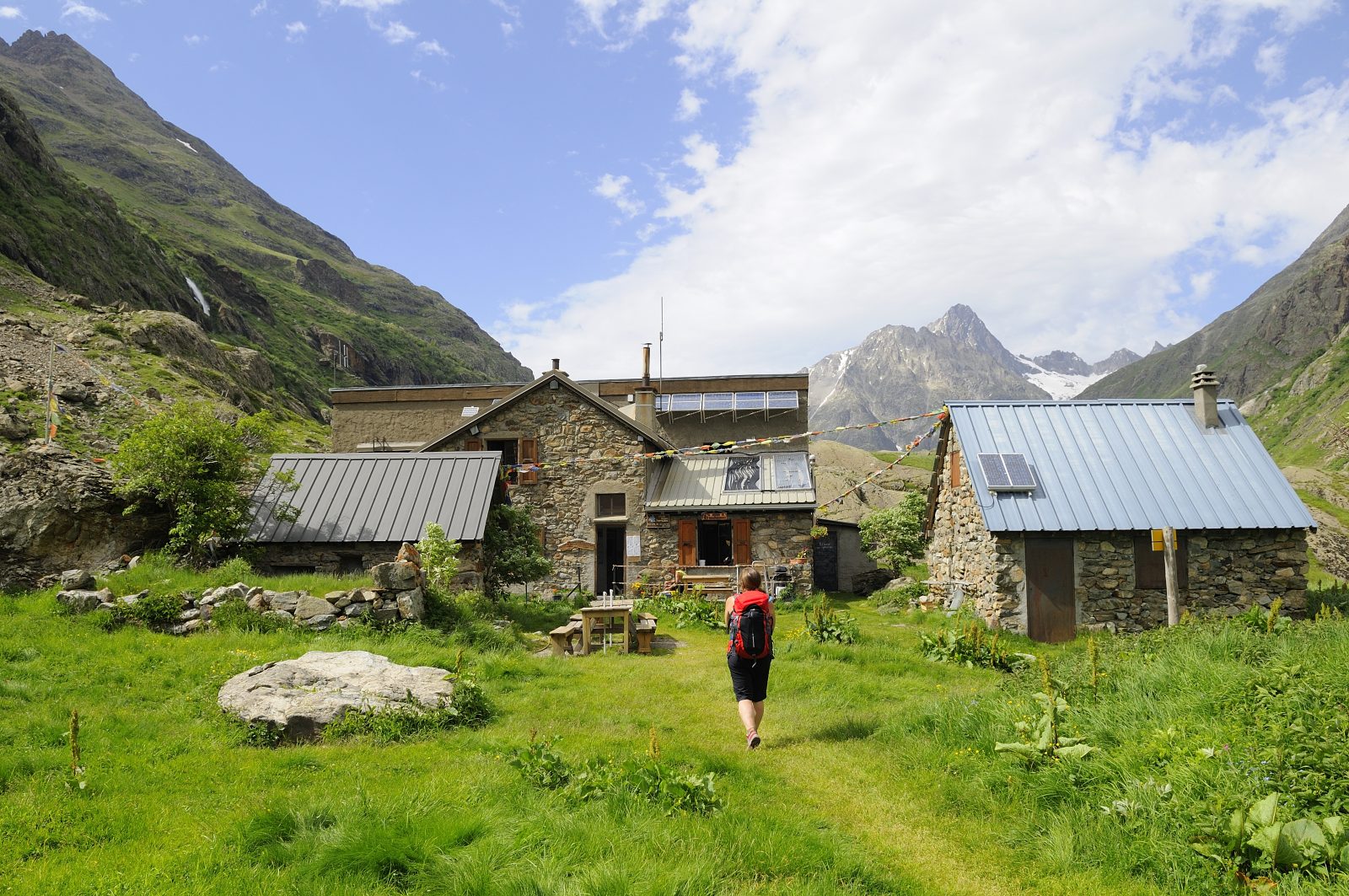
After a "country" climb, you reach the mountain pastures of the upper Lavey valley. The refuge stands as a reminder of pastoral life.
Refuge temporarily closed
About : Hiking – Refuge et vallon de la Lavey
The RD530 leading to the Vénéon valley is closed to vehicular traffic, from the intersection with the RD1091 (at Clapier d'Auris) to the hamlet of Les Étages (Saint-Christophe-en-Oisans), via Venosc (Les Deux Alpes).
Today, the mountain pasture is inhabited by two flocks of sheep, but you can also observe chamois, marmots, foxes and birds around the refuge.
TECHNICAL INFORMATION
Departure point: St-Christophe-en-Oisans (Champhorent)
Ascent: 400 m
Round trip duration: 2h30 outward, 1h15 return
Distance: 9.4 km
Technical and physical level: easy
MAP AND TOPO
OBP n° 5 (Oisans au Bout des Pieds) trail 531
IGN TOP 25 n°3336 ET
YOU'RE HIKING IN THE HEART OF THE ECRINS NATIONAL PARK
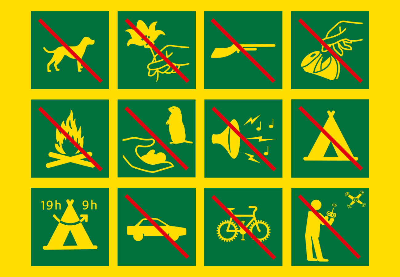
The Écrins massif is an exceptional area, open to all, with a rare natural, cultural and landscape heritage. To protect these treasures, the heart of the park is marked with blue-white-red painted flags, where regulations must be respected. Please take note of them when planning your hike to preserve this collective asset on the ecrins-parcnational.fr website.
ITINERARY
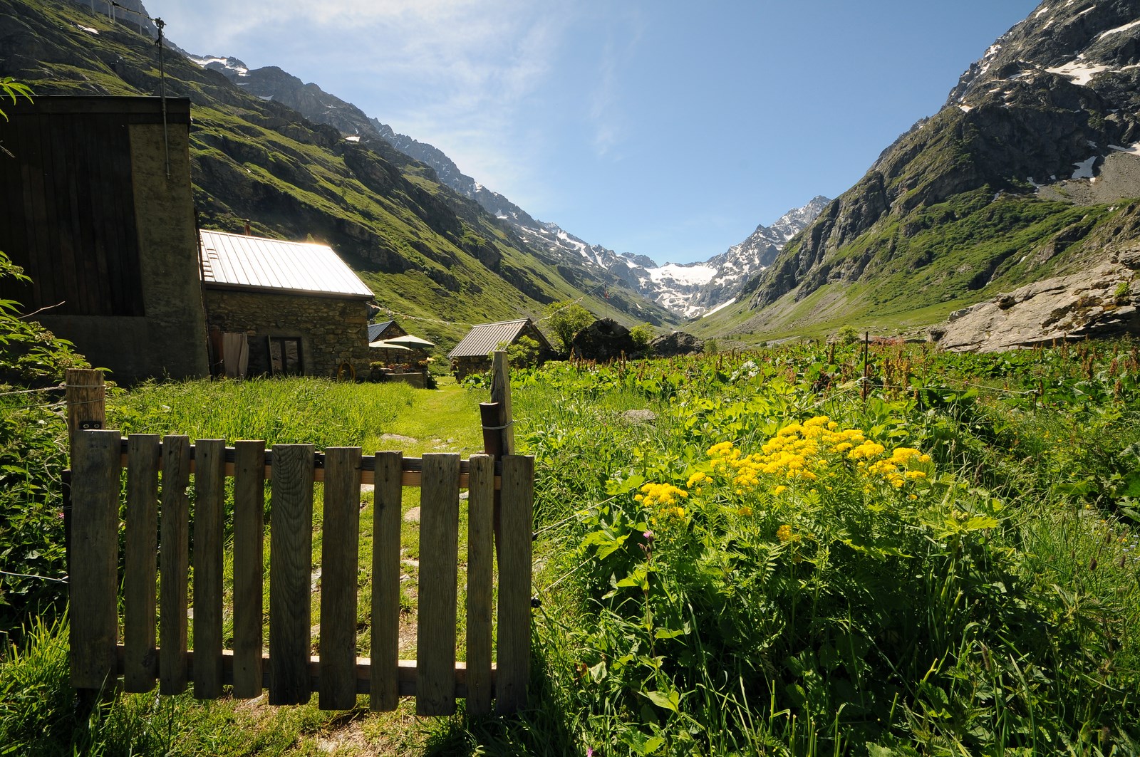
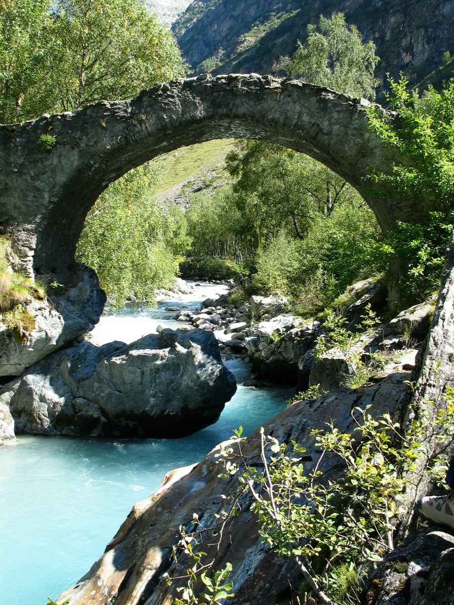
The parking lot is at the entrance to the hamlet of Champhorent (3 km after St Christophe en Oisans), below the road. Take the path at the end of the parking lot down to the Vénéon torrent and its magnificent Pont des Rajas. Cross the pretty stone bridge and climb towards the Rajas houses. Continue uphill to enter the Vallon de la Muande and follow the torrent on the right bank, then on the left bank after a second stone bridge. At the shepherd's hut, cross the gently sloping slabs to reach the refuge hidden behind this small glacial lock.
Return via the hamlet of Souchet (OBP no. 5 - path 566).
THE PARC DES ECRINS, A FRAGILE NATURAL ENVIRONMENT TO PROTECT
When hiking in the Parc des Ecrins, you must respect the regulations that allow you to enjoy this exceptional natural area: do not leave the trails, dogs are forbidden even on a leash, do not pick flowers or collect fossils, minerals, animals..., do not throw anything on the ground (bring your own garbage). Nature thanks you!
NOTES
- The refuge is guarded from mid-June to mid-September and offers snacks during the day.
- The Lac des Fétoules is signposted from the refuge.
- From the refuge, you can hike for several days to Lac des Bêches (2h) and Lac des Rouies (4h).
- You are in the Ecrins National Park, so respect the regulations: don't leave the paths, no picking, no fires... To respect the fauna, dogs are forbidden (even on a leash).
En bref
2 h 45
J+ : 400 m
9.4 km
Level bue - Medium
Map and GPX marking
Hiking – Refuge et vallon de la Lavey
Saint-Christophe-en-Oisans - La Bérarde
Services
Tours
- Average duration of the individual tour: 165 minutes
Opening
From 15/05 to 31/10.
Subject to favorable snow and weather conditions.
Prices
Free access.
This service provider also offers


Saint-Christophe-en-Oisans - La Bérarde

Saint-Christophe-en-Oisans - La Bérarde

Saint-Christophe-en-Oisans - La Bérarde
Location supplement
Inside the Ecrins National Park boundary; no dogs allowed, even on a lead.