484610-diaporama
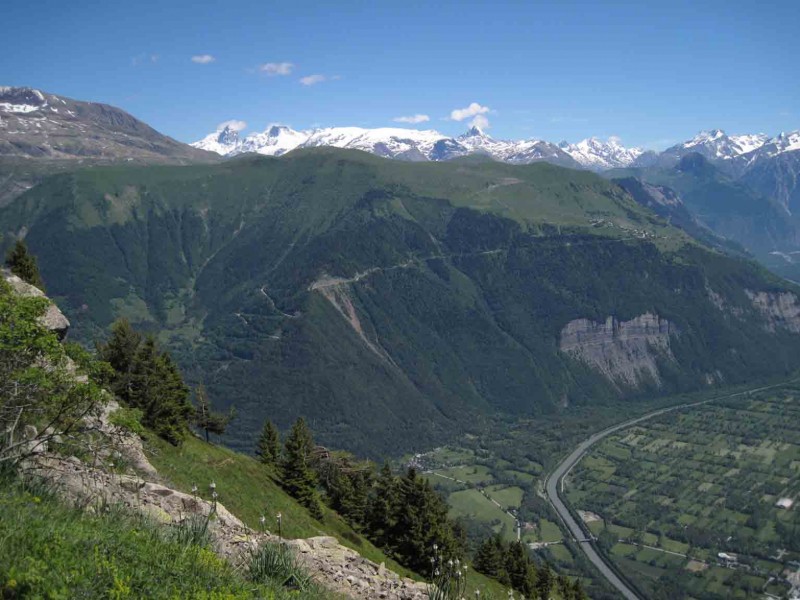
This hike gives you panoramic views over the lower part of the Eau d'Olle valley and Bourg d'Oisans.
About : The mines of Challanches – Hiking
TECHNICAL INFORMATIONS
Starting point: Parking of the hamlet "La Traverse" (Allemond)
Elevation gain: 636 m
Distance: 2,9 km
Time : 2h (climb), 1h35 (downhill)
Level: Easy
MAP
IGN TOP 25 n°3335 EST
OBP n°2 (Oisans au Bout des Pieds) : trail 210
ROUTE
From the hairpin bend after La Traverse, continue 500m, the path starts uphill on the left. It begins in the forest then opens out over a series of small valley wich may be difficult depending on the previous winter conditions.
A different descent is possible by 210 bis (1h55 return route).
CULTURE
The Chalanches mines, wich were exploited during Louix XVI's reign, were rich in different minerals, but difficult to eploit in such high mountains.
En bref
3 h 55
J+ : 650 m
7.5 km
Level red – hard
Map and GPX marking
The mines of Challanches – Hiking
Allemond
Services
- Pets welcome
Services
Tours
- Average duration of the individual tour: 235 minutes
Download
Opening
From 01/05 to 31/10.
Subject to favorable snow and weather conditions.
Prices
Free access.
Location supplement
In Allemond follow towards "Allemond Eglise". Turn on the left just before the cucrh, towards "La Traverse". After "La Traverse" hamlet park your car in the next turn. The path begins a little higher on the left (following the road).