484610-diaporama
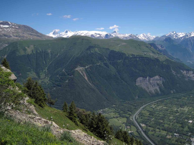
This hike gives you panoramic views over the lower part of the Eau d'Olle valley and Bourg d'Oisans.
About : The mines of Challanches – Hiking
TECHNICAL INFORMATION:
Departure: parking lot in the hamlet of La Traverse (Allemond)
Height difference: 636 m
Duration: 2h outward journey, 1h35 return journey
Distance: 2.9 km (one way)
Level: moderate (avoid with young children - 2 ravine crossings equipped with handrails)
MAP AND TOPO :
IGN TOP 25 map n°3335 EST
OBP map no. 2 (Oisans au Bout des Pieds): trail 210
ITINERARY:
Reach the hamlet of La Traverse (6 km from the bottom of the village) by following the road above the church. Park on the bend after La Traverse.
Climb to the Chalanches hut:
Take the path opposite the parking lot that enters the woods to reach point 1259 and join the signposted path.
Follow it northwards, then fork left at a higher point towards Les Chalanches (signs).
Continue along the Chemin de Ferret, which opens out southwards onto the Bourg d'Oisans depression.
Carefully cross two ravines (Drayre Grande and Drayre Creuse), the second of which is equipped with a handrail to compensate for its regular erosion.
The path continues on a balcony, then forks abruptly to the north and climbs fifty meters to a large flat where the Chalanches hut (1806m) is nestled.
The view is open here, offering splendid panoramic views over the plain of Bourg d'Oisans, the Écrins and Grandes Rousses massifs, as well as the austere north face of the cime du Cornillon.
You can come back down by the same or another route (210 bis on OBP map no. 2, 1h55 descent).
Descent and end of the Chalanches loop:
Take the signposted path to the left of the hut (west) and follow it.
It descends due south over a number of short switchbacks until you reach point 1297. It then branches off to the east to make the long traverse of the south face of the Chalmettes mountain (Combettes wood) and reach the parking lot.
CULTURE :
The Mines de Challanches, exploited under Louis XVI, have provided a rare diversity of minerals.
These ancient silver mines, located at an altitude of almost 2000 meters, were discovered by a young shepherdess in 1767. They were mined for some thirty years in the 18th century. They were famous at the time, producing up to 600 kg of silver a year. At their peak, they employed around a hundred workers, whose working conditions, given the altitude, were very difficult. The area is considered one of France's most remarkable mineralogical sites, with some sixty species of mineral discovered on site, helping to make the Oisans a world-renowned center for mineralogy.
En bref
3 h 55
J+ : 650 m
7.5 km
Level red – hard
Map and GPX marking
The mines of Challanches – Hiking
Allemond
Services
- Pets welcome
Services
Activities
- Duration of the session: 235 minutes
Tours
- Average duration of the individual tour: 235 minutes
Download
Opening
From 01/05 to 31/10.
Subject to favorable snow and weather conditions.
Prices
Free access.
This service provider also offers

Location supplement
In Allemond follow towards "Allemond Eglise". Turn on the left just before the cucrh, towards "La Traverse". After "La Traverse" hamlet park your car in the next turn. The path begins a little higher on the left (following the road).