778968-diaporama
778971-diaporama
778976-diaporama
10176794-diaporama
A great lookout point with a 360° panoramic view of the Massif des Ecrins and its legendary summits.
About : Tête de la Maye
TECHNICAL INFORMATION
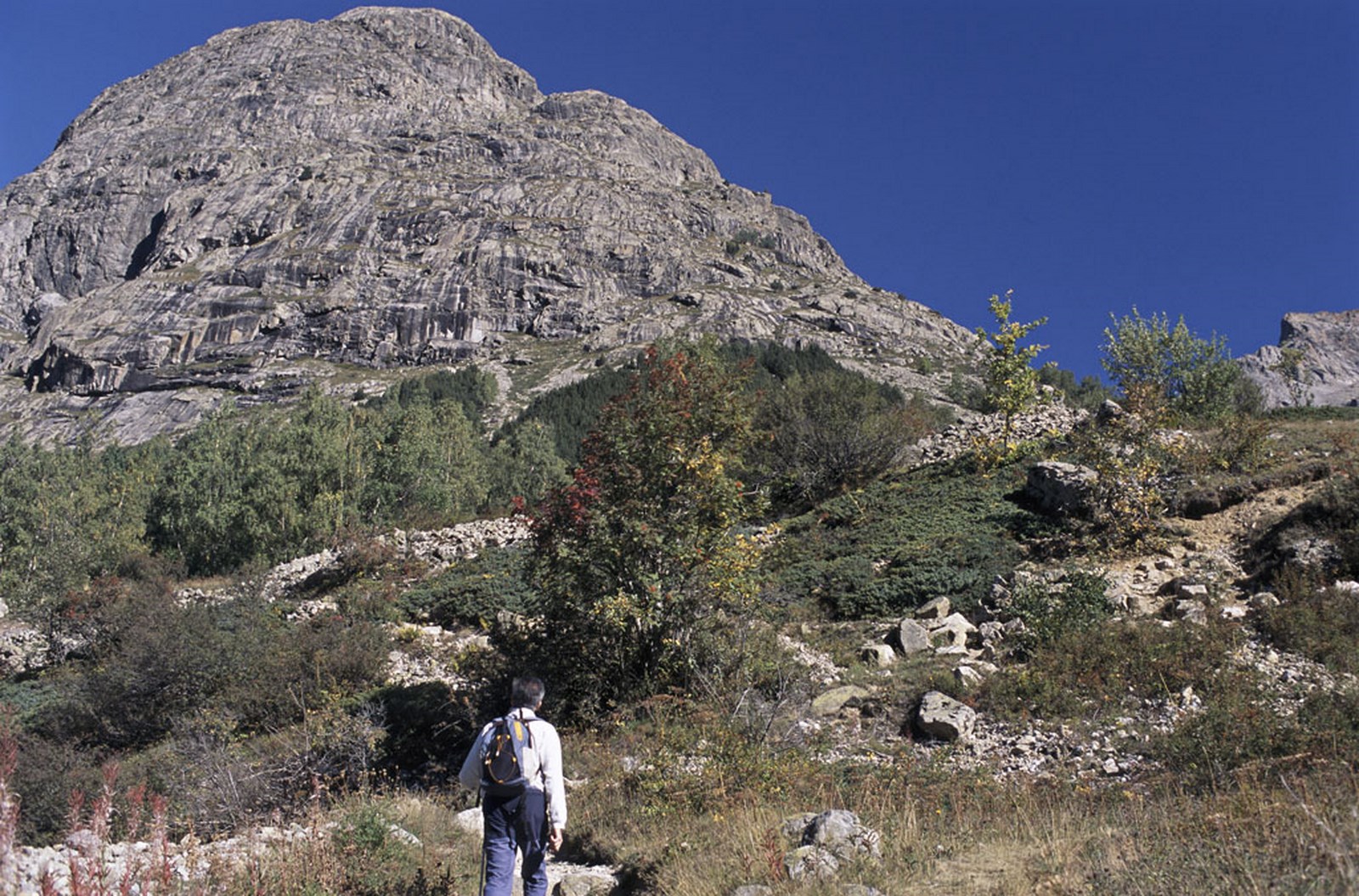
Starting point: Hamlet of la Bérarde
Height gain: 808 m
Total duration: 2 1/2 hours
Distance: 2.8 km
Level: Difficult
ROUTE
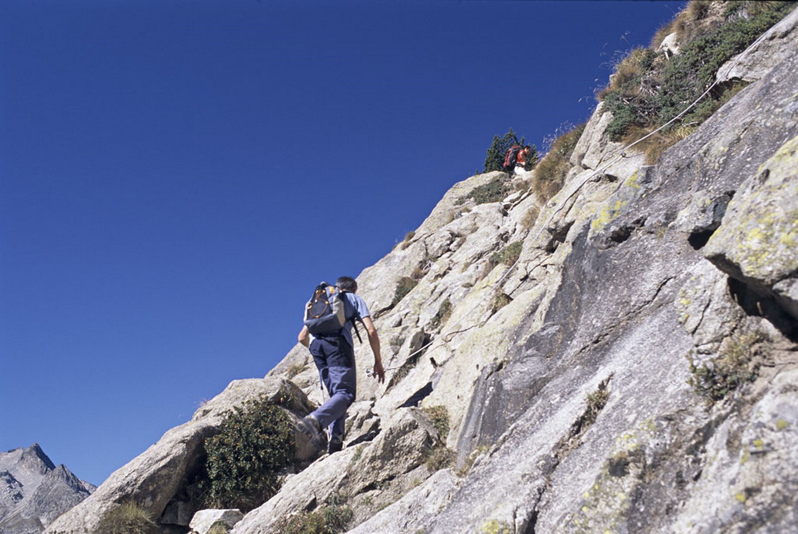
At the entrance to La Bérarde, take the path which starts before the bridge. It winds its way up through pine and birch trees to the junction with the path to Les Etançons. Take the left hand fork. The path then becomes quite tricky, going round rocky outcrops and crossing rock slabs fitted with bars and cables. The climb is physical and exposed.
DURING THE HIKE
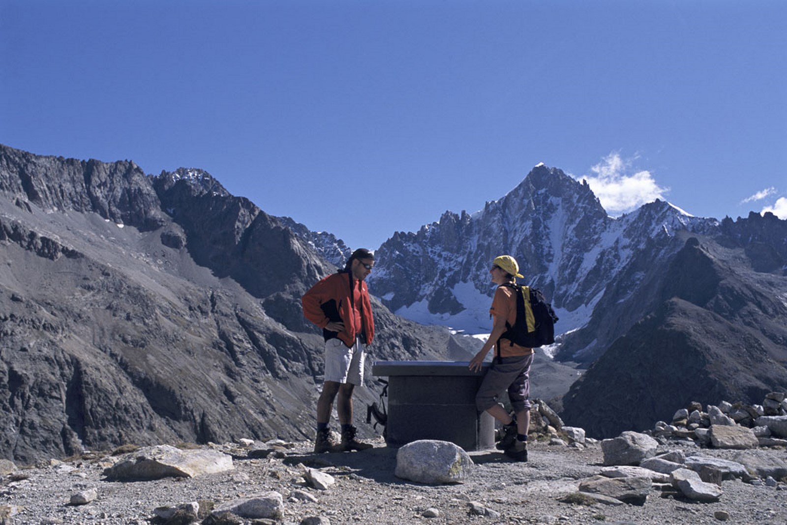
The summit has a panoramic map table enabling you to identify the legendary surrounding mountains.
EXTRA INFO
Important: this path is well equiped with cables but particularly exposed and not suitable for people afraid of heights or in and after wet weather, as the rock slab remains wet and slippery.
Minimum age: 12 years
En bref
2 h 30
J+ : 808 m
2.8 km
Level black - very hard
Map and GPX marking
Tête de la Maye
Saint-Christophe-en-Oisans - La Bérarde
Opening
From 01/06 to 31/10.
Subject to favorable snow and weather conditions.
Prices
Free access.