
Refuge du Taillefer par Oulles ©Oisans Tourisme
Refuge du Taillefer par Oulles ©Oisans Tourisme
Refuge du Taillefer par Oulles ©Oisans Tourisme
Refuge du Taillefer par Oulles ©Oisans Tourisme
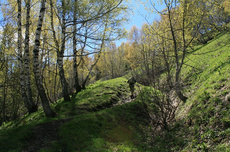
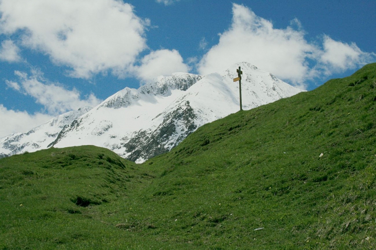
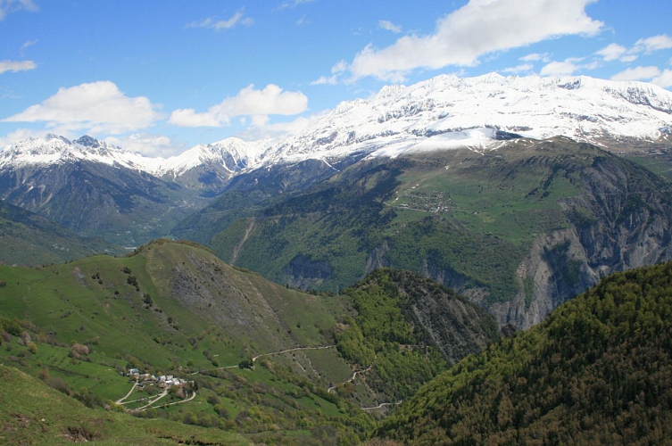
Starting from Oulles, the path leading up to the Taillefer mountain hut offers one of the clearest views over the Oisans mountain tops, from the Rousses to the Ecrins.
About : Refuge du Taillefer par Oulles
The Taillefer Plateau is a Natura 2000 site, where many species of flora and fauna are protected and sensitive, so we need to adapt our behavior so that the landscape and biodiversity continue to amaze us:
- I stay on the marked trails (paint, signs...). I don't take shortcuts that cause soil erosion, destroy vegetation and disturb wildlife and herds.
- I keep my dog on a leash to avoid disturbing wildlife and domestic herds.
- I don't make fires in the mountains. It destroys the soil for decades.
- I bivouac outside wetlands and pitch my tent at suitable times (7pm-9am).
- I don't litter.
- I don't pick flowers. I prefer a lasting souvenir by taking a photo.
- I ask about private ownership of certain areas.
TECHNICAL INFORMATION :
Start: Car park at the entrance to the village of Oulles
Ascent: 700 m
Duration: 2h30 uphill
Distance: 3.9km
Level: Medium
MAP AND TOPO :
OBP map n°1 (Oisans au Bout des Pieds): trail 636
IGN Top 25 map n°3335 OUEST
ITINERARY:
From Oulles, take the road to the hamlet of Pouillard, then follow the carriage road, leaving it after around 750 m for a path on the right.
The path becomes steeper and offers fantastic views of the village of Oulles and all the Oisans massifs. It then enters the mountain pastures, passes under the Carrelet communal chalet and crosses to the Taillefer refuge.
En bref
2 h 30
J+ : 700 m
3.9 km
Level bue - Medium
Map and GPX marking
Refuge du Taillefer par Oulles
Oulles
Services
Tours
- Average duration of the individual tour: 150 minutes
Download
Opening
From 01/05 to 31/10.
Subject to favorable snow and weather conditions.
Prices
Free access.
This service provider also offers


