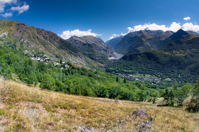
The Courbe site offers a pleasant afternoon stroll on the sunny slopes of the Grandes Rousses massif. You can visit the village of Clavans before returning.
About : Puy le bas > La Courbe – Hiking
Above Puy-le-Bas, the path crosses over. The slope then steepens through the alpine pastures to reach a rockier area and finally the Rocher de la Courbe.
TECHNICAL INFORMATION
Start: Puy le bas
Ascent: 500 m
Round trip time: 3h30
Return distance: 7.4 km
Level: medium
ITINERARY
After crossing Puy-le-Bas, the carriage road turns right to the champ de Bonnefond, where the path is signposted on the right. Enjoy the freshness of the water intake. Continue until you reach a wide bend in the road, where the path turns right into a meadow, still well-marked as far as La Courbe. You pass under the Bec de l'Aigle (where you may spot chamois!).
You can continue on to the ruins of the chalet, where cairns indicate the way through the site to find the path down to Clavans. To avoid the village, look for a little-used, unmaintained path 50 m below the descent, which leads to a wider path from Clavans. Shaded area. Climb up to the Follet oratory and continue through the woods along the side of the Clapière to reach Puy-le-Bas.
WHAT TO SEE NEARBY
- The hamlets of Puy le bas and Puy le haut and their small chapel.
- View of Lac du Chambon and the Ecrins massif
Visitor alert
As this route is potentially subject to severe damage due to major weather events and its viability may be uncertain, please enquire before embarking on it.
En bref
3 h 30
J+ : 660 m
9.7 km
Level bue - Medium
Map and GPX marking
Puy le bas > La Courbe – Hiking
Le Freney-d'Oisans
Services
Activities
- Duration of the session: 210 minutes
Tours
- Average duration of the individual tour: 210 minutes
Download
Opening
From 01/06 to 31/10 : open daily.

