20727139-diaporama
20727140-diaporama
20727141-diaporama
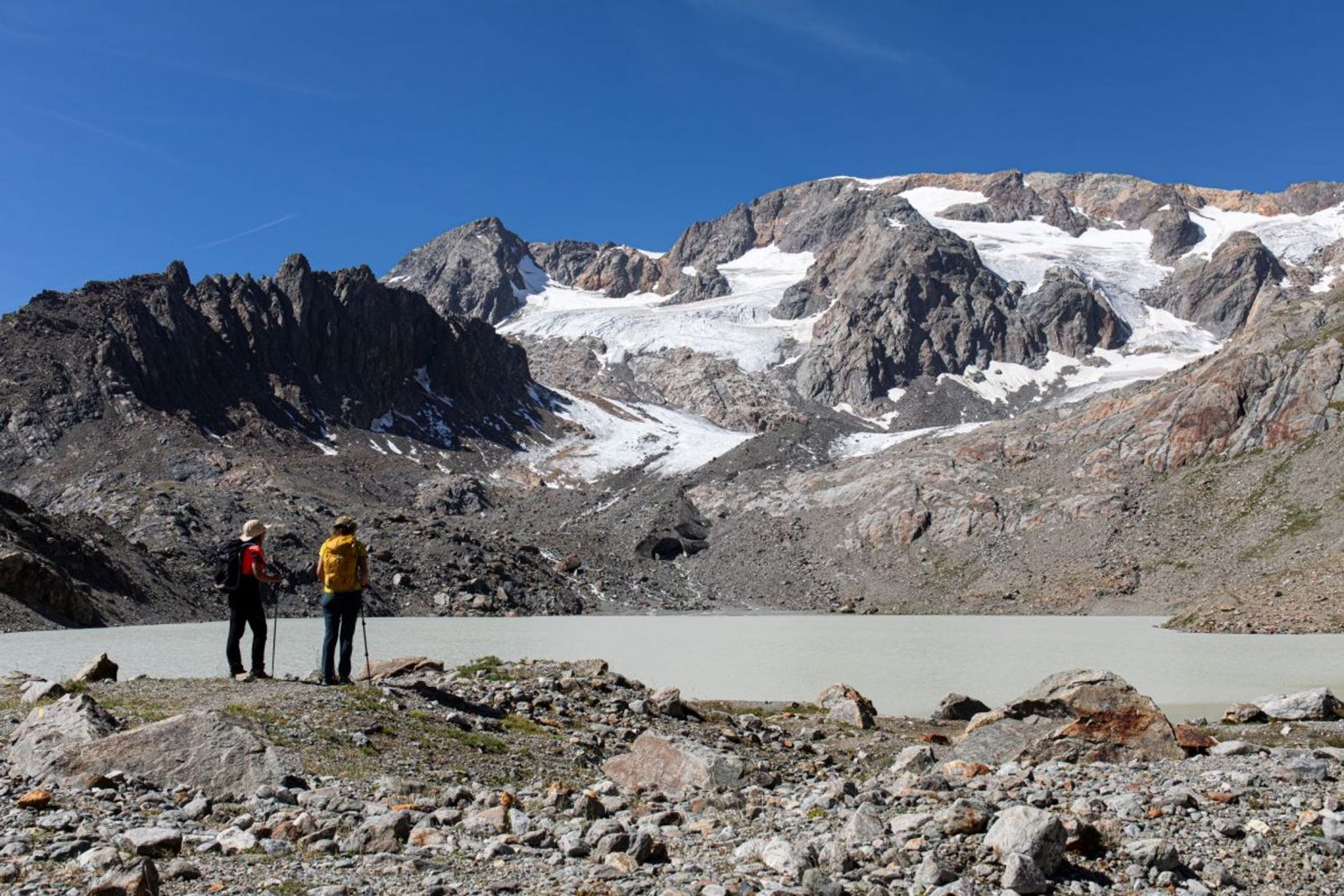
A wonderful hike in the Ferrand valley, between the Grandes Rousses mountain range and the Emparis plateau to reach a lake that appeared only recently after the retreat of the glacier.
About : Lake Quirlies
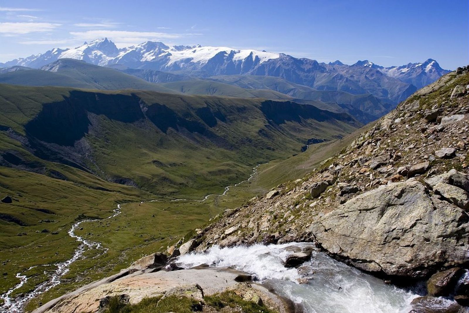
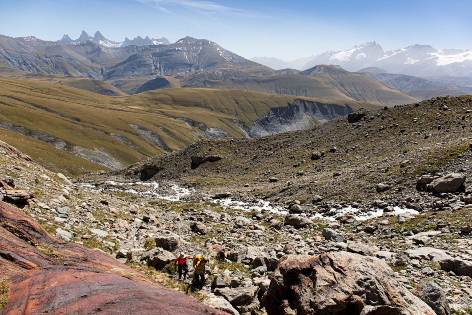
Follow the Sarenne pass road above Clavans-en-haut-Oisans to reach the hamlet of Perron. Park at the information board of the classified site of Le Ferrand. Before leaving with you rucksack, take a look at the house that is backed against the rock. Set off on the signed footpath to get to the Ferrand footbridge and the majestic waterfall. Head up the wide track overlooking it, then cross another footbridge that leads progressively into a very green valley by staying on the right bank of the stream. The footpath then takes a pleasant route crossing many small streams coming from the higher valleys. Walk successively past the footpath that leads to Clos Chevaleret (a hike for another day), the Bruyères pastoral hut and close to a sheep pen and the bottom of the valley. On this large flat terrain, you will need to cross the stream to head further up to Pierre de l'Oiseau. Leaving the footpath to the Sauvage summit to the right, turn left to follow the one that leads up to the lake. This route is only ice-free as of mid-July. The return trip is made by the same itinerary up to Le Perron.
Welcome: Medium
En bref
6 h 00
J+ : 944 m
13.51 km
Download
Prices
Free of charge.
Location supplement
Departure : Le Perron (Clavans-le-Haut).
At the Chambon dam (N91: Bourg-d'Oisans>Col du Lautaret) turn onto the D 25 go past Mizoën then Clavans-le-Bas and Clavant-le-Haut as far as Perron. From l'Alpe-d'Huez, in the summer, follow the Sarenne road beyond the aerodrome. Go over the pass and down into the Ferrand valley as far as Perron.
Parking recommended : Parking du Peron, Clavans-le-Haut .