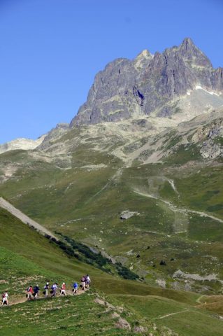
This is one of the most spectacular 360° views, from which you can admire the Meije, Muzelle, Pic Blanc and Aiguilles d'Arves. If you're lucky, you may spot marmots, lammergeier vultures and chamois.
About : Hike to La Croix de Cassini
La Croix de Cassini is a 90-minute circular walk for medium-fitness hikers starting from the Col de Sarenne, although more experienced hikers have the option of starting from Clavans for a 3½ hour hike (950m height gain).
The recommended route is from the Col de Sarenne.
From Grenoble, drive to Bourg d'Oisans (D1091) and then on to the Col de Sarenne either via Alpe d'Huez or the Ferrand Valley, which is an opportunity to visit the traditional villages of Mizoen, Clavans and Besse (after Bourg d'Oisans, follow signs to Briançon and then after crossing the Chambon dam, take the first on the left towards Clavans and then on the the Col de Sarenne). From Alpe d'Huez, park at the Rocher du Goulet car park or drive to the Col de Sarenne.
Park at the Col de Sarenne (1999m), from where you can walk to the Croix de Cassini along the ridge. Take care though, as, although not marked on maps or signs, this route (the most direct) does have a few tricky sections. So, even though the view from the ridge is amazing, this route is only suitable for sure-footed hikers.
More cautious hikers should carry on down the road a little after the Col (towards Alpe d'Huez and some chalets) and take the path to the Col Grange Pellorce from Le Sella (on the left). This is a slightly longer route (around 90 minutes to reach the top), but it is safer underfoot. If you're lucky, you may spot marmots, lammergeier vultures and chamois. Once at the Croix de Cassini (2361m), your efforts will be rewarded with a unique panoramic view over the surrounding peaks and valleys.
In the 18th century, César-François Cassini was assigned the ambitious task of mapping the Kingdom of France. His name has been given to a number of summits, including the Croix de Cassini, which he used to make his measurements. Cassini maps, which were drawn over 250 years ago, are as precious as our modern IGN maps.
Services
Activities
- Duration of the session: 90 minutes
Tours
- Average duration of the individual tour: 90 minutes
Download
Opening
All year round.
Subject to favorable snow and weather conditions.
Prices
Free access.
This service provider also offers
Location supplement
Map and guidebook: "Oisans au bout des pieds" no. 2 / IGN TOP 25 no.3335 ET


