16942728-diaporama
16942729-diaporama
16942730-diaporama
Discover two magnificent lakes and a complete nature reserve that is closely studied by scientists.
Overnight stay at the Muzelle refuge (reservation essential).
Itinerary with public transport proposed by Alpes Là.
About : Car-free hike 2 days / 1 night- Les lacs de la Muzelle et du Lauvitel
Please note: this site is located in the heart of a French National Park and is subject to specific regulations. This is an exceptional area, and as such is subject to specific regulations. We invite you to adopt the right reflexes when you come to protect these treasures.
Start: Bourg d'Arud Camping (954 m) - 1 h 10 (2 km, D+ 321 m, D- 12 m)
From the stop, cross Bourg d'Arud on the D530 (heading south-east). Cross the bridge over the Vénéon and turn right through the hamlet of l'Alleau and its fountain-washhouse. Then follow the GR54® path rapidly rising through the forest to reach a characteristic ruin.
1) Ruine du Pleynet (1249 m) - 3 h (4.4 km, D+ 900 m, D- 30 m)
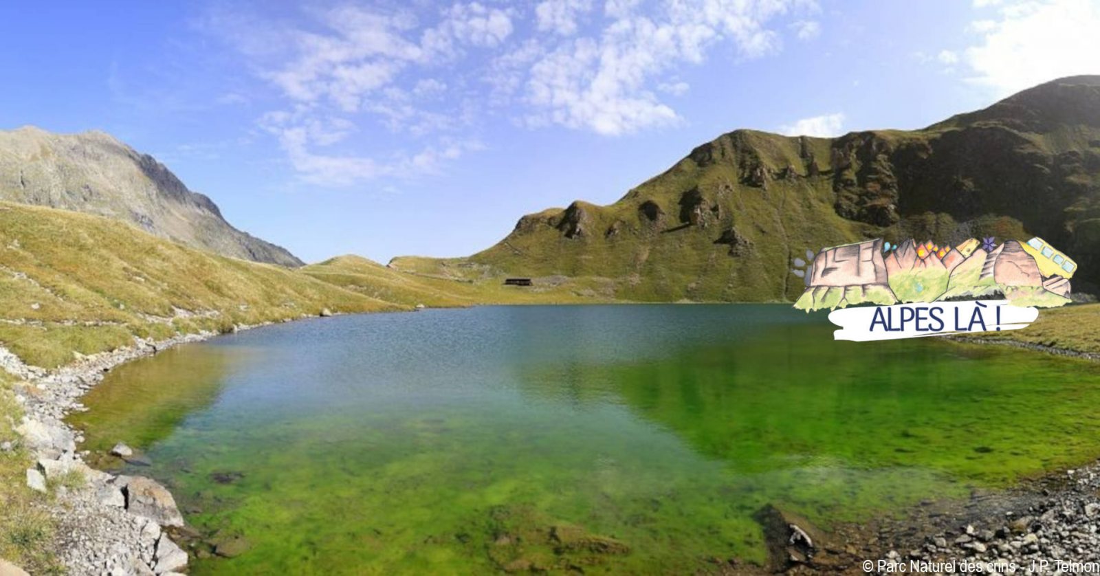
Follow the path along the torrent de la Pisse, with its beautiful waterfalls. At the Chapeau Roux waterfall, the path crosses the torrent via a footbridge, then continues up steep switchbacks to reach a peat bog flat. Five hundred metres further on, you come to the refuge and Lac de la Muzelle in its glacial cirque, where tongues of the hanging glacier
glacier.
2) Refuge de la Muzelle (2130 m) - 1 h 30 (2.4 km, D+ 413 m)
Follow the path along the edge of the lake until you cross a footbridge (2102 m). Turn due west for the route to the Col du Vallon, which winds its way among rocks (cairns) and then winds its way up a steep, more open slope.
3) Col du Vallon (2531 m) - 1 h 45 (4.3 km, D+ 37 m, D- 1,058 m)
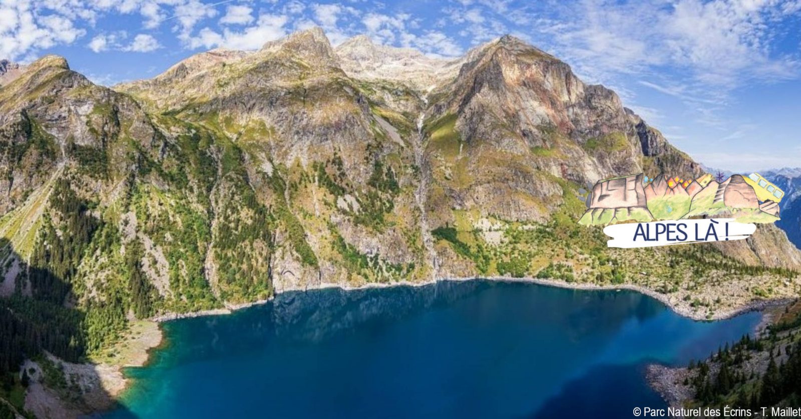
Descend the pass on the north-west side along the path. At around 1750 m, the path bends northwards to cross a ravine (a tricky passage on a rocky slab). After a brief ascent, we descend a few hairpin bends to reach the north shore of Lac Lauvitel. To the south of the lake, an integral nature reserve forbids the presence of man.
4) Lac du Lauvitel - Les Selles (1501m) - 50 min (2.4 km, D- 484 m)
Descend to the Pont des Balmes on the north path, towards La Danchère via Les Selles, along a beautiful paved path and remarkably well-maintained low walls.
Welcome: Bivouac from 7 pm to 9 am, more than an hour's walk from the Ecrins National Park.
Visitor alert
A car-free hike where you can take the bus to and from the site. Make sure you know the time and day of traffic before you leave.
Please make arrangements for overnight bivouacs.
En bref
4 h 30
J+ : 1677 m
17.2 km
Level red – hard
Map and GPX marking
Car-free hike 2 days / 1 night- Les lacs de la Muzelle et du Lauvitel
Les Deux Alpes
Opening
From 27/05 to 30/09.
Prices
Plan the cost of the trip by Bus Cars Région.
This service provider also offers
