6769056-diaporama
6774040-diaporama
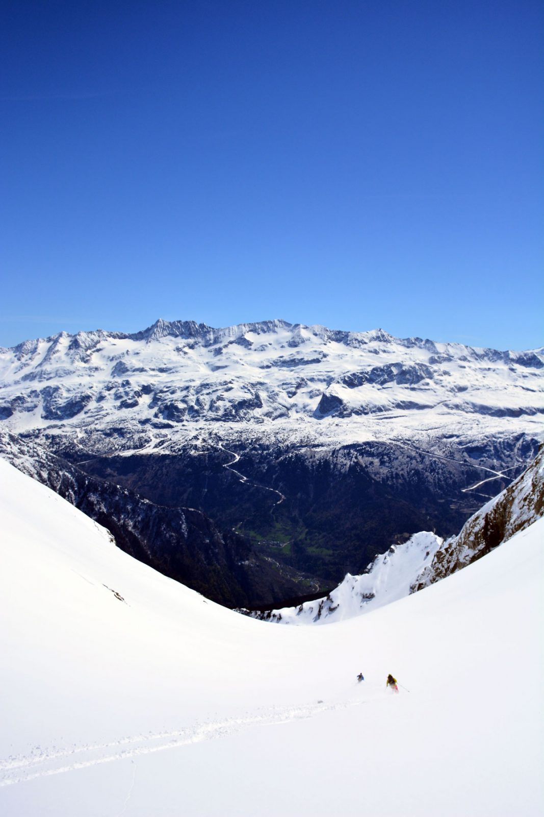
Once in the Eau d'Olle valley, the many wonderful opportunities for skiing open up before your eyes… Allemond marks the entrance into the valley and La Traverse is located just above.
About : Ski touring from La Traverse (Allemond) / Eau d’Olle
SUGGESTIONS FOR SKI-TOURING
> Classic day routes :
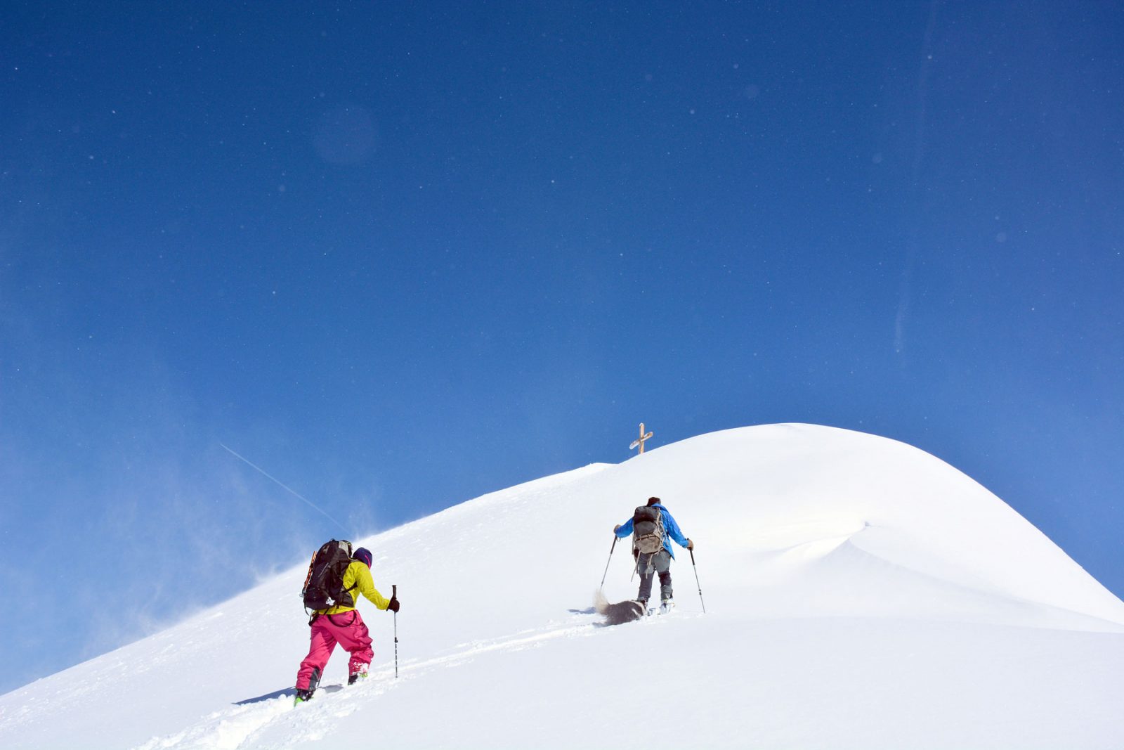
- Croix de Belledonne (2926 m) + 1850 m
A fine traverse to the always beautiful and spectacular Croix de Belledonne. Climb up via the Cabane du Chazeau (1718 m) and the Lac de Belledonne.
- La Grande Roche (2483 m) + 1350 m
An untamed route just above Allemond, with a steep climb up to the summit. Skiers often see chamois on this route!
> Technical and steep routes :
- Grand Pic de Belledonne (2978 m) + 1950 m
A steep and demanding climb. Take care, as the eastfacing slopes warm up quickly in the morning sun.
PRACTICAL INFORMATION
> Getting supplies: Allemond: bakery, general grocers, restaurants.
> Accommodation: Allemond: hotel, B&Bs, gîtes.
> Comments: There is a lot of height gain/loss involved as this side of the mountain range has no mountain huts to break the route, although you will find shepherd’s huts and shelters. They are marked on the IGN map and you can also find information on D refuges.info
EAU D'OLLE / BELLEDONNE SECTOR
As soon as your enter Oisans from Grenoble, the Eau d'Olle valley catches your eye... and lures you back again and again… it’s so varied and so beautiful! The routes extend from the village of Allemond up to the Col de la Croix de Fer, from the foothills of the Belledone to those of the Grandes Rousses.
The pointed peaks on the horizon tease city-dwellers during the week and each weekend, the summits cause a mini-exodus from the city to the mountains. Yet approaching from the Oisans side, on skis from the Eau d'Olle valley, you’re sure to be well away from the crowds.
There are different versions of the origin of the name “Belledonne”. Some say it comes from “bella donna”, as Italian workers thought the shape of the Grand Pic looked like the Virgin carrying her child. The Gauls, on the other hand, used the word “belo” to mean strong or powerful, which accurately describes this solid crystalline mountain range, 60 km long, with wide shoulders but narrow 10 km hips.
The highest point, the Grand Pic de Belledonne, verges on 3000 m. It sometimes looks arrogant like the Fitzroy in Patagonia or a black virgin, depending on your point of view. In any case, the Belledonne is a real natural barrier, a citadel of schist and gneiss (and a little granite, of course) and is one of the most untamed mountain ranges in France.
/!\ IMPORTANT
Ski mountaineering and touring involves risks and all skiers are responsible for their own safety. Make sure you follow ANENA guidelines: anena.org
En bref
French
Prices
Free of charge.
Location supplement
Once in Allemont, follow signs to “Allemont Eglise” (to the left off the straight section of the main road). From the church, follow signs to La Traverse. Park in the car park on the bend just after the hamlet.